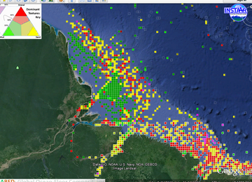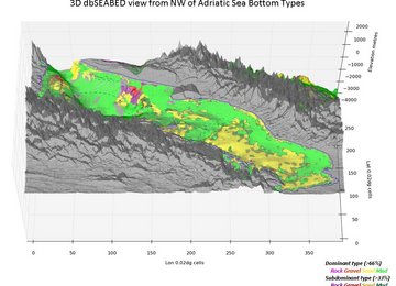


Seabed data around the Philippines
Under project work for future regulation of global deep-sea trawling, methods for map-interpolation of seabed characteristics have been extended.

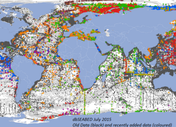
dbSEABED is an ocean information system, directed to a better understanding of the entire world's ocean floor: the seabed - its composition, structure, and physical properties.
The motivation for this long-term project is better human custodianship of the oceans. It does this by increasing public awareness of the oceans, and by helping advances in research, technology, and maritime laws.
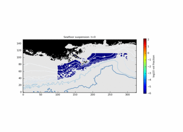
Recent projects have been in fisheries management, carbon, human impacts on the seafloor, seafloor movement under extreme storms, and the hydrodynamics of objects.
dbSEABED has large advantages as a system. It covers all zones from coastal to the distant deep-ocean, from pole to pole. It is a research collaboration, unaffected by national boundaries.
In order to characterize the seabed with good resolution, the system amasses multitudes of diverse data sets (total 6 million observations) and employs unique methods for merging word-descriptive and numeric-analytical datatypes.
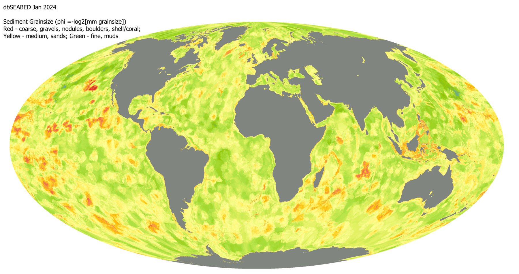
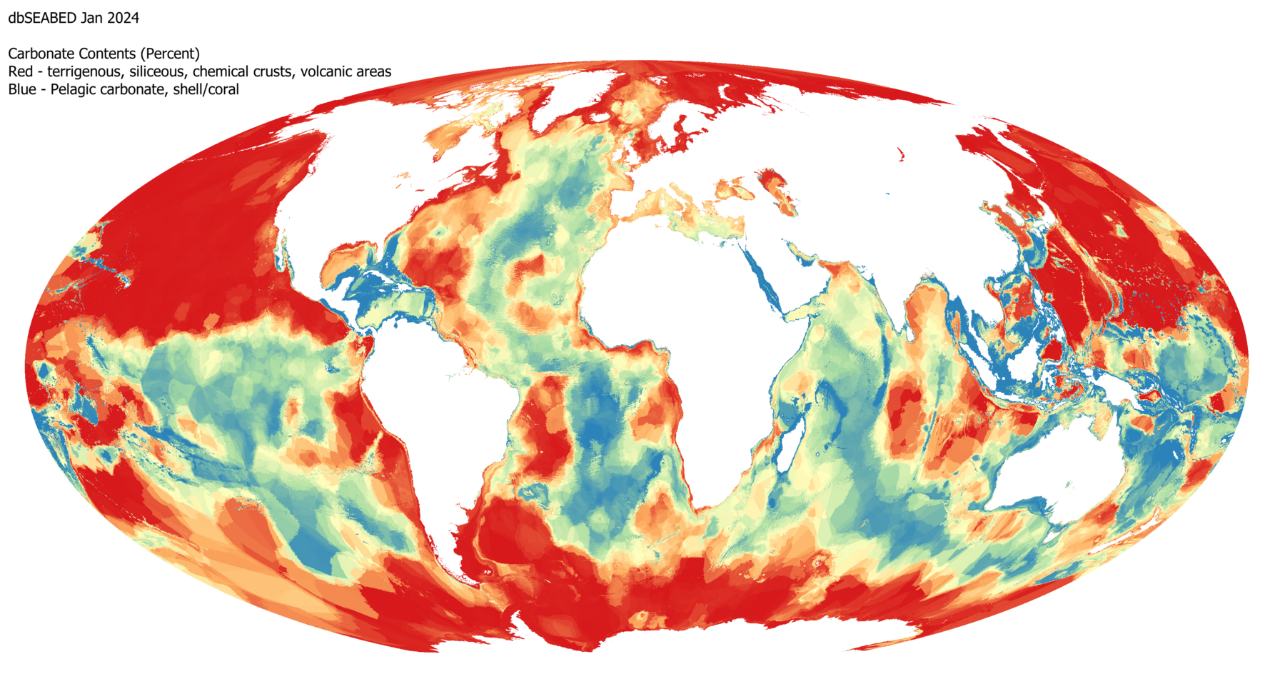
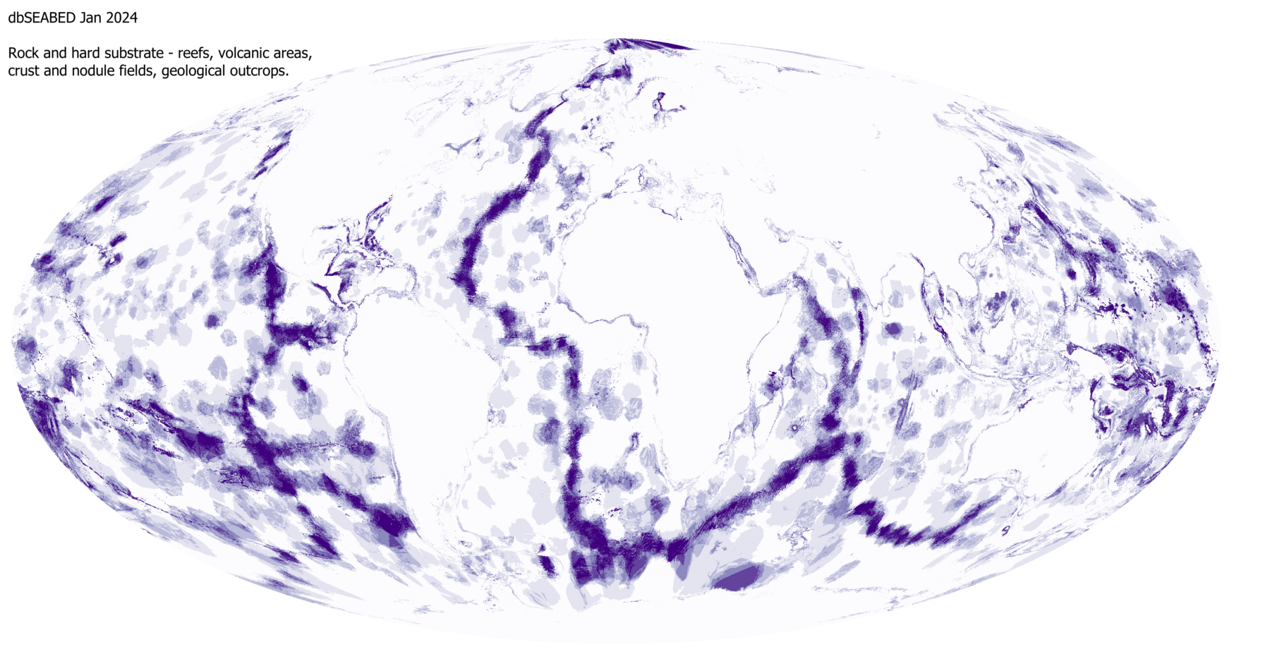
Data comes in from the geo- and bio- sciences, engineering, navigation and defence, ocean resources, and even tourism - all to build a representative, unbiased coverage. The output data addresses seabed strengths, grainsizes, mesoscale features, colors and bulk chemistry. The integrated, quality-controlled products interface straightforwardly with client tasks in ocean mapping and statistics, machine learning, and numerical process-modeling.
The project always appreciates new data to add to the system and information from users on their applications for the data.
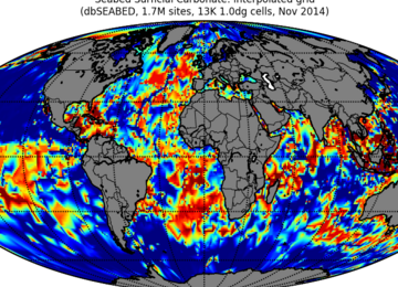
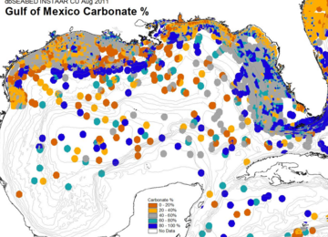
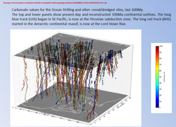
Global data (grain size, carbonate and rock)